
- Startsida
- En
- Experience
- Culture and history
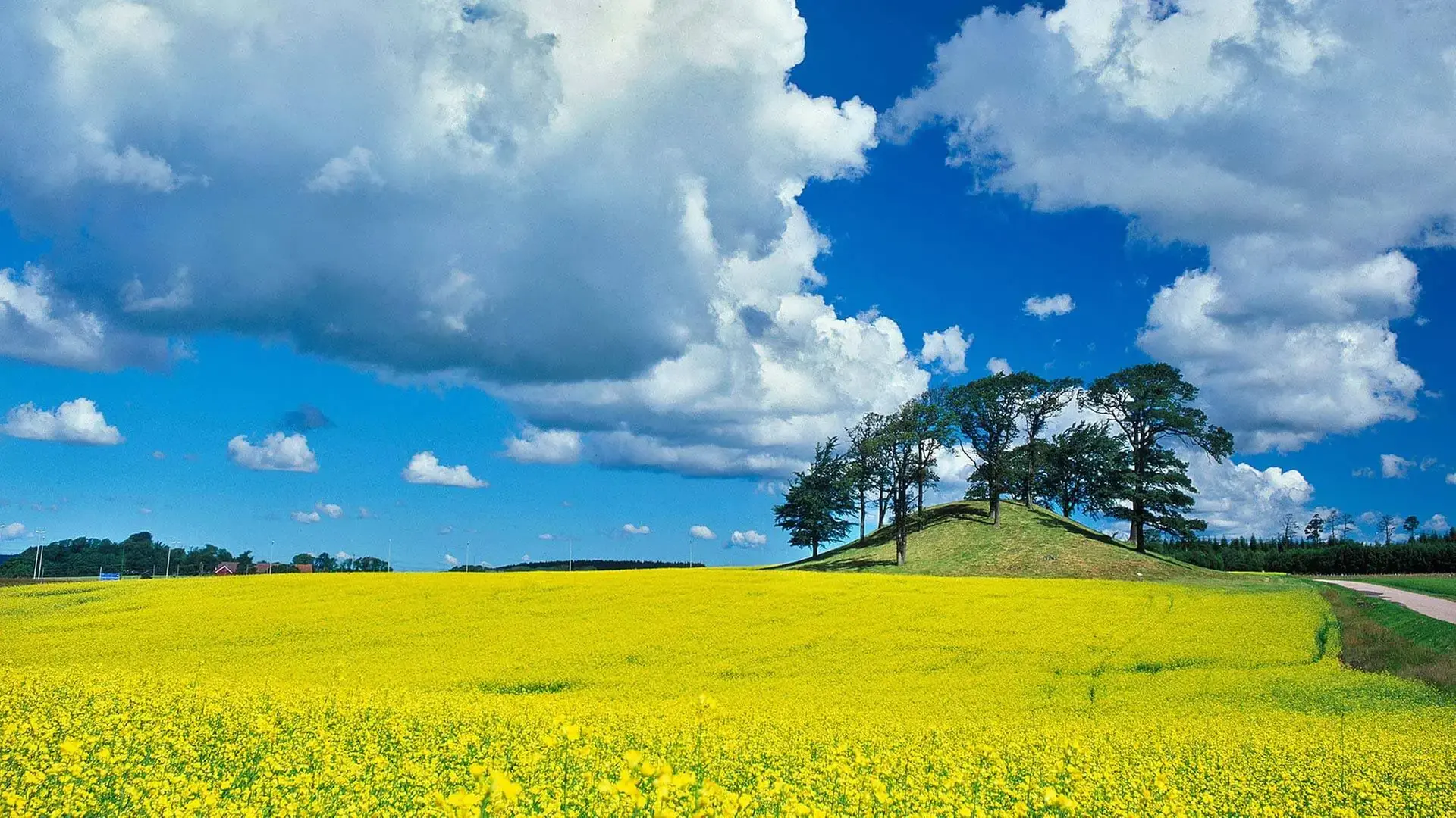
- Historic highlights in Halmstad
Historic highlights in Halmstad
Take a deep dive into Halmstad's history and discover exciting places with fascinating stories around. Also take the opportunity to go on a historic city walk in central Halmstad.
Click the icon in the top right corner of the map to open in Google Maps. To view and hide different layers, as well as to see all visitor destinations, click on the icon in the top left corner of the map. The map is in Swedish.
The Battle of Nissan
On the afternoon of the 9th of August 1062, Halmstad witnessed the Battle of Nissan, one of the Nordic countries’ largest sea battles of the Viking period. Legend has it that the Danish force comprised 300 Viking ships, while the Norwegian Vikings had only 150 vessels. Go for a walk on Prins Bertil's Trail and stop at Örnäsudde. At Örnäsudde or at our page about the viking battle you can read more about what transpired and imagine the mighty Viking battle that took place just off the coast of the cape.
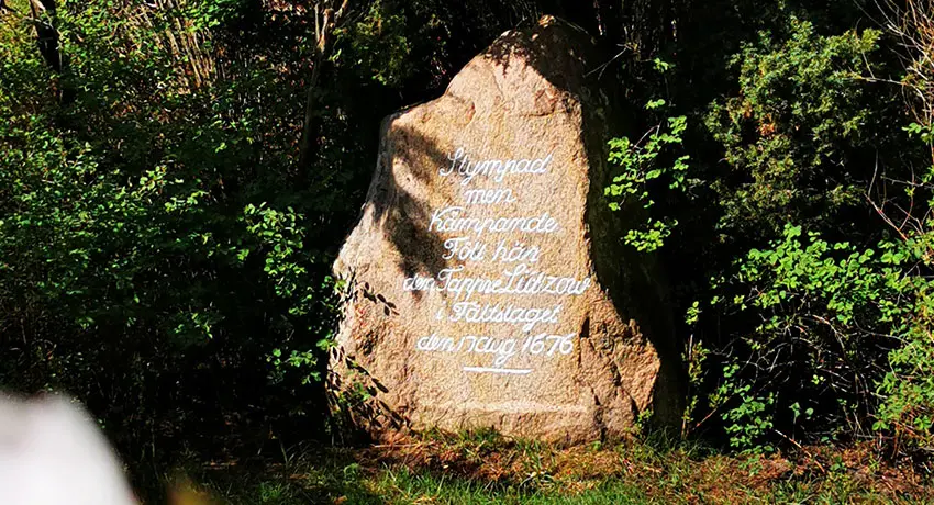
The Lützow Stone
The Battle of Fyllebro and the Lützow Stone
The Battle of Fyllebro, also known as the Battle of Halmstad, took place on the 17th of August 1676. This decisive battle of the Scanian War was to be the last battle between Danes and Swedes in Halland. In Fyllinge you will find three interesting places that tell the story of this historic battle: A information board, a memorial, and the Lützow Stone. The latter was erected in honour of Johan Friedrich Lützow, a German lieutenant colonel in Danish service, who is said to have singlehandedly killed 17 Swedish soldiers before he himself met his death.
Ivars Kulle
Ivars Kulle is a four metre-high barrow and is located on a natural hill created by the inland ice. This makes it an excellent place for a picnic, as it offers wonderful views of the nearby fields. During an excavation in 1972, five graves were discovered that are believed to date all the way back to the Early Bronze Age or Iron Age. The name of the hill is originally from a person named Givar Gunnarsson, who is said to have worked the land here between 1717 and 1756.
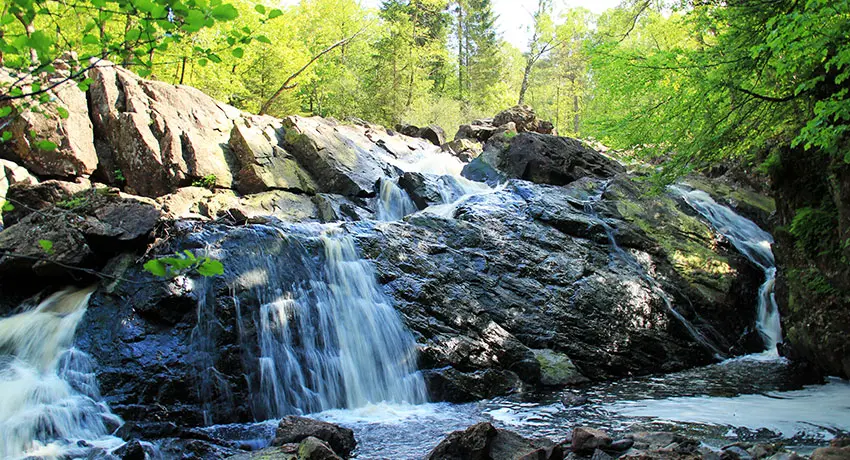
Danska Fall
Danska Fall and the Jörnasfors Iron Mill
The Danska Fall Nature Reserve and waterfall are said to have taken their name from old local lore about the Battle of Fyllebro. Part of the Danish Army is said to have fled upwards along the Fylleån River and, with the Swedes hot on their heels, the soldiers sought shelter in the forest near the waterfall. As the fleeing Danes were running across a suspension bridge, the Swedes cut the ropes. The bridge and the Danes plummeted into the water. If you follow the river downstream you will find remnants of Jörnasfors, which in the 18th century was one of Halland's largest ironworks.
Gårdshult
Just south of Simlångsdalen lies the Gårdshult Nature Reserve (Swe) External link, opens in new window.. Here you will find beautiful, flower-filled hay meadows, natural pastures with large clearance cairns and stone fences. In addition to this magical cultural landscape, you can see and experience how the land here was used, right up until the 1950s. Located in the building known as Ladan, the museum farm uses only traditional farming methods. Seeds are sown by hand and large parts of the meadow are harvested with a scythe. If you follow the hiking trail to Björkekulle, you can enjoy a lovely view all the way to Halmstad.
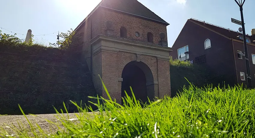
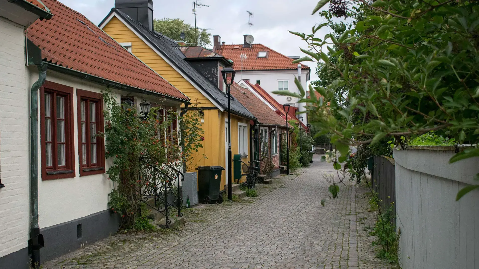
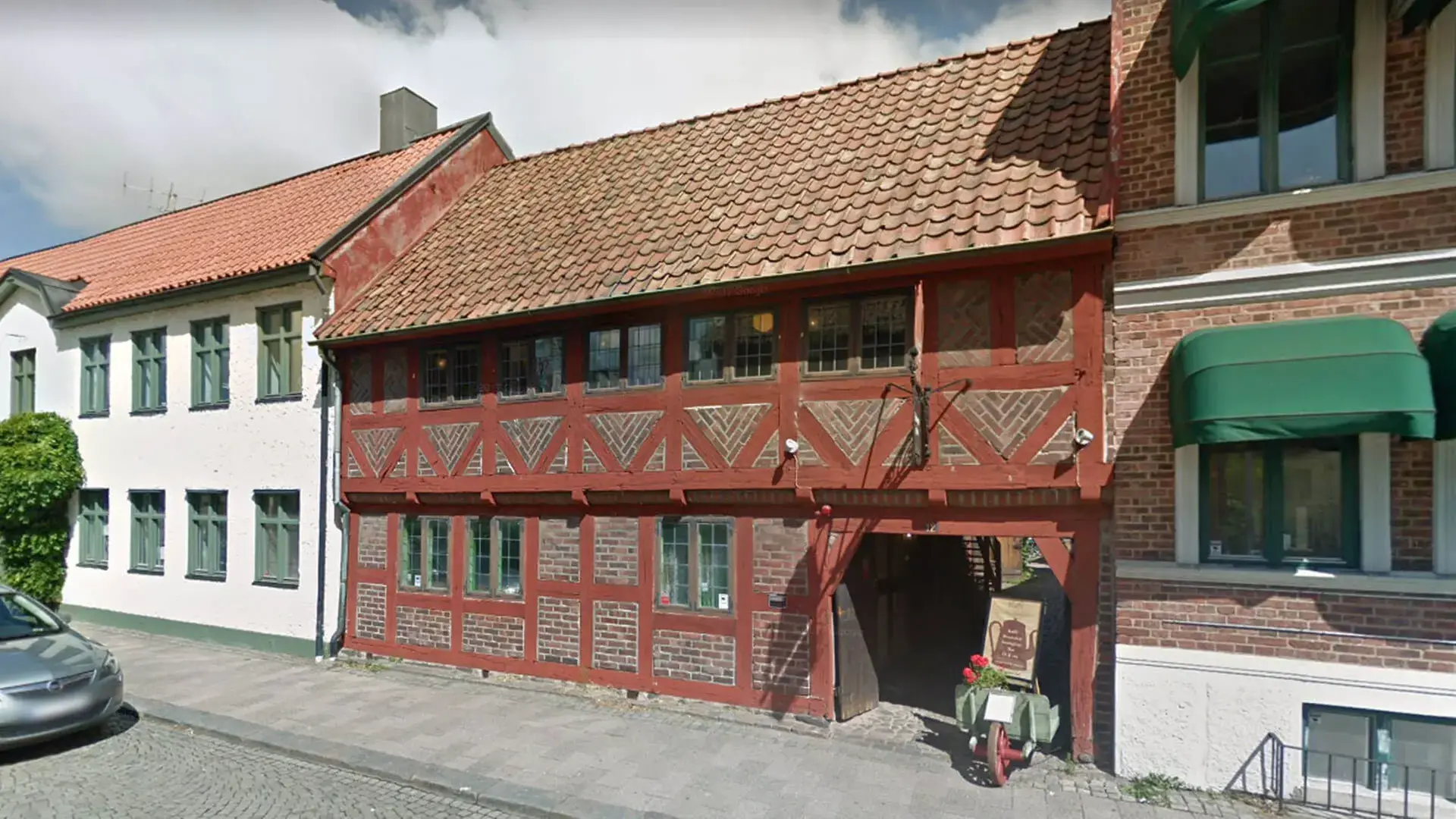
Norre Port
Norre Port
Completed in 1601, Norre Port is the only one of Halmstad's four original city gates that has survived until the present day. The gates were constructed based on blueprints provided by the fortress architect Hans van Steenwinckel at the request of the Danish King Kristian IV. The aim was to modernise the border fortifications against Sweden. Norre Port faces Galgberget, which at the time was a natural place from which to launch an attack. Norre port was part of Halmstad's fortress.
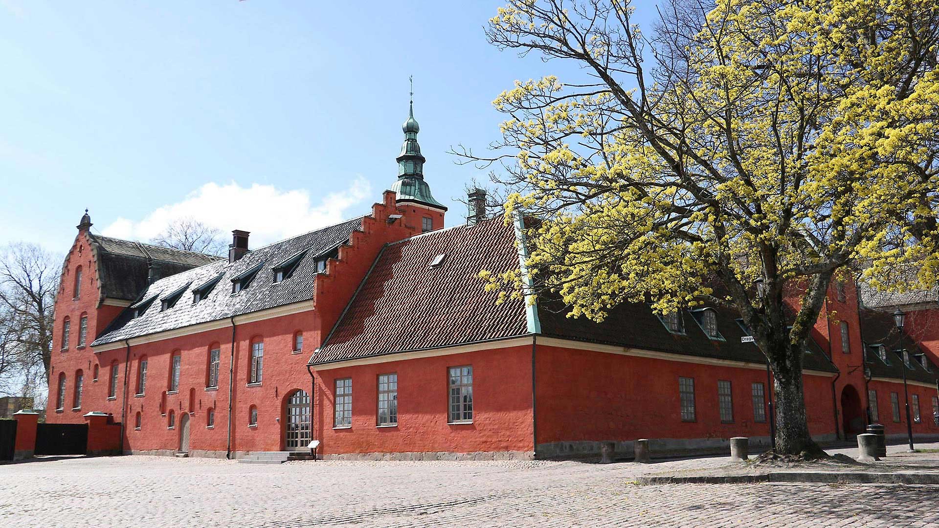
Halmstad Castle
Halmstad Castle was built as a pleasure palace for King Kristian IV of Denmark, and was completed in 1619. However, the Danish royal family was not able to enjoy their pleasure palace in Halmstad for very long. Halland became Swedish in 1645, and the castle became the residence of the Swedish kings during their visits to the city.
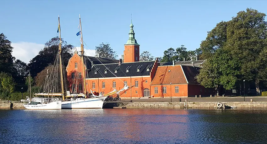
Halmstad Castle
Svalilt Water Mill
To visit Svalilt Water Mill follow the blue and white marked paths in Simlångsdalen or take a short walk southeast of Svalilt, along the Vekaån River. The Svalilt Water Mill has not been in use since 1938, but remains well-preserved.
In the past, every village had a water mill that used hydropower to grind grain between horizontal millstones. Lake Håraltsjön served as a water reservoir, and this water was released as needed, allowing numerous water mills to use the resulting hydropower. Have a look inside the mill and learn more about how it was used.
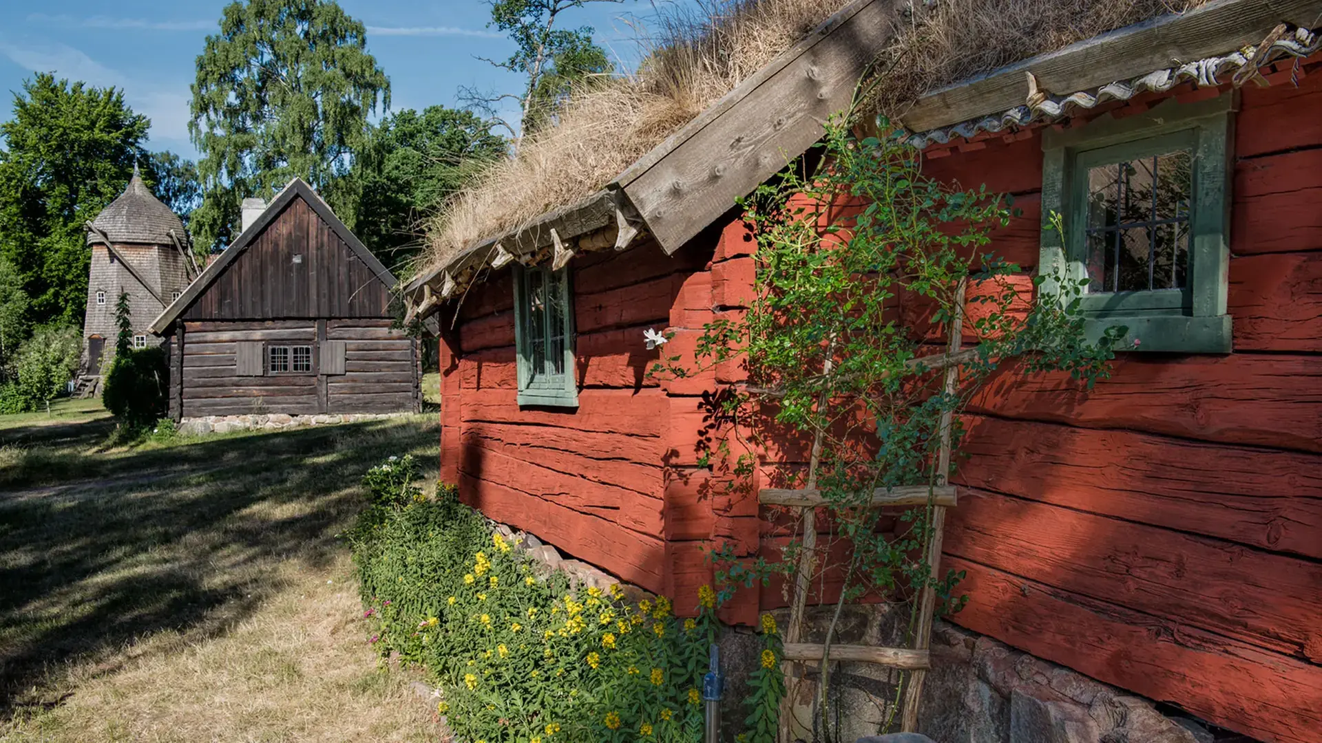
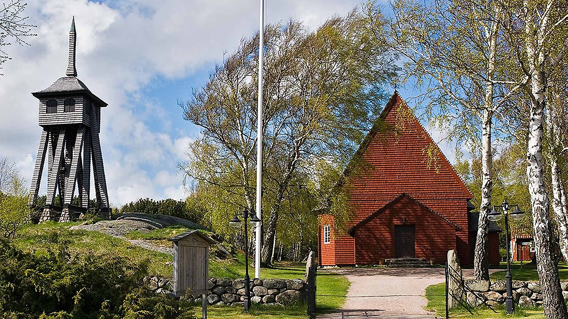
Hallandsgården and Galgberget
The scenic Hallandsgården open-air museum has been situated on Galgberget in central Halmstad since 1925. It comprises old buildings collected from various parts of Halland. Galgberget all the way back in the last Ice Age, around 14,000 years ago. The ice sheet transported vast volumes of stone and gravel, and these were deposited when the ice began to melt. The name Galgberget can be traced back to the period during which, by all accounts, the hill was used as an execution site. More specifically, the name is derived from the gallows that stood on the hill (the Swedish word for gallows is galgar, and berg means hill). These gallows were used to hang prisoners who had been sentenced to death.
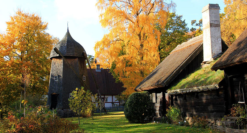
The Hallandsgården open-air museum
Virsehatt Hillfort
Atop the 70 metre-high, dome-shaped hill known as Virsehatt, remnants of the walls of a hillfort and two bowl pits have been found. The location at the top of the hill provides ideal protection against unrest, and its rocks and precipices must have made it extremely difficult to conquer the fort. It is also said that in ancient times, elderly people were forced to throw themselves off the steep precipices. When they could no longer support themselves or contribute to the work on the farm, they threw themselves off the rocks, towards certain death.
Long-believed legends claimed that giants and trolls used the hill as their abode. Today you can go on a digital treasure (swe) External link, opens in new window. hunt here – great fun for the whole family! Don't miss the beautiful Virshultsstugan (swe) External link, opens in new window. log cabin at the foot of the hill.
The Persson Brothers' Village Shop Museum
In Simlångsdalen you will find the Persson Brothers’ Village Shop Museum, also called the Lyckebo Shop. This well-preserved village shop was run by the brothers Rudolf and Alvar Persson. During World War II, it became too difficult to handle all the ration coupons and the brothers closed the shop, which was left untouched until 1984. The museum is run by the Breared Cultural History Association and its opening hours vary. Visit our museum page for more information and more exciting museums in Halmstad.
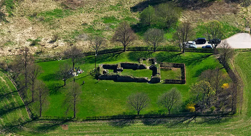
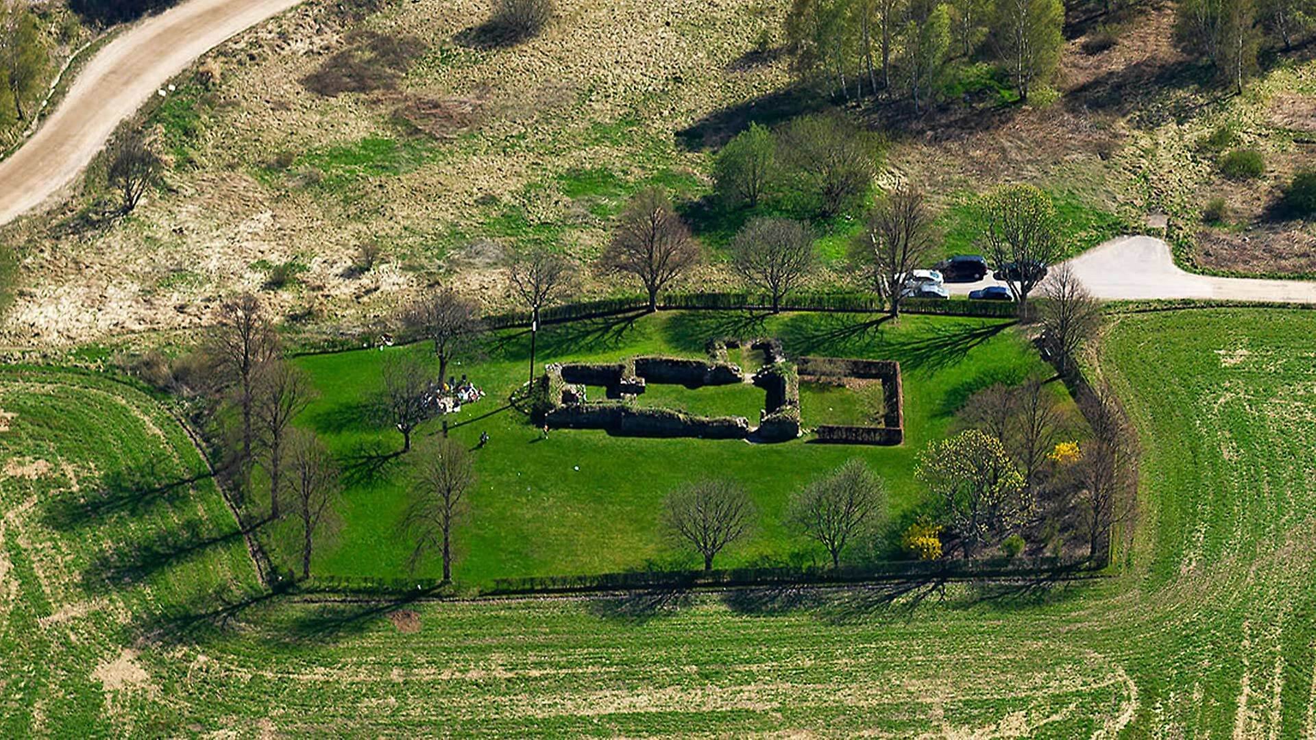
The Ruins of Övraby Church
The Ruins of Övraby Church
Halmstad has not always been situated in its current location. Until the 14th century, the town was located in the area now known as Övraby and now consists of Övraby church ruin. A stave church is believed to have been built here as early as the 11th century, and is believed to have been called Maria Church. This structure was subsequently replaced by a stone church in the 12th century, the ruins of which have survived to this day. Starting in the 1320s, the town shifted to Halmstad’s current location. In 1563, the Swedish King Erik XIV made a failed attempt to conquer Halmstad, and Övraby fell victim to the Swedes.
Karlstorpsstugan
This old cabin was previously located in Kärleken, where it was known as Södra Övrabygården. It was the last farm before Halmstad, and many people spent the night here, because the city's gates were closed at night. The Swedish King Karl XI spent a night in the cabin shortly after the Battle of Fyllebro. In 1783 the cabin was moved to its present location and renamed Karlstorp.
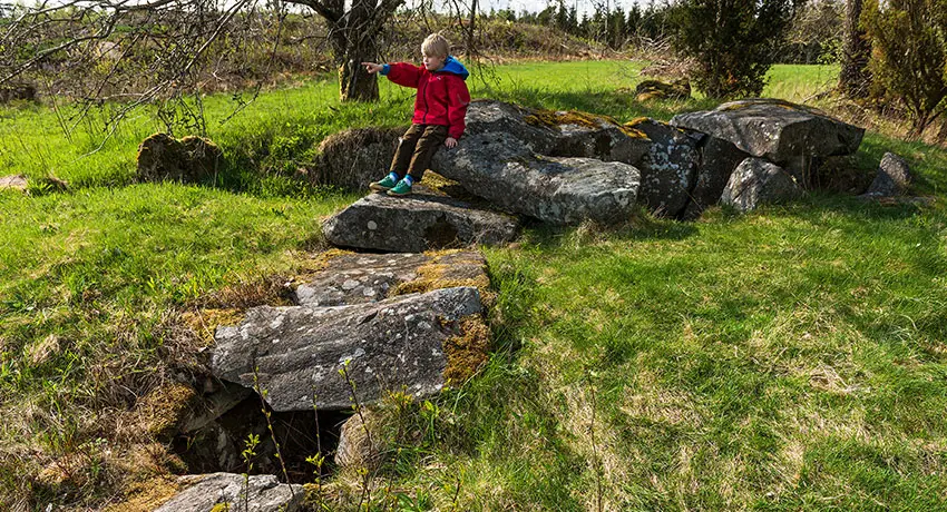
The Tolarp Chambered Long Barrow. Photo: Patrik Leonardsson
The Tolarp Chambered Long Barrow
The chambered long barrow in Tolarp from the Younger Stone Age is approximately 5,000 years old, which is about the same age as Stonehenge. Stone Age people erected the blocks to give their dead relatives a last, dignified resting place. The dead were often placed in a seated position. When archaeologists examined the tomb in 1926, they found amber beads, a flint chisel, and pot shards. The chambered long barrow is located on the south side of the Fylleån River, just east of the Årnarp Nature Reserve.
The Stonemasonry in Söndrum ang Grötvik
Between 1876 and 1965, one of the quarries in Söndrum was the largest in all of Sweden. Several hundred men worked there around the clock, and the port was full of boats onto which the rock was loaded and shipped to both Europe and America. The mottled red stone of Söndrum can be found in the Presidential Monument in Washington, the Peace Palace in The Hague and the Swedish Church in Paris. Today, nature has taken back large parts of the old stonemasonry. In addition to remains from the stonemasonry work, gunpowder cellars can still be found where explosives were stored. Visitors can also investigate several memorial stones and enjoy panoramic views from Spritkullen Hill in Grötvik.
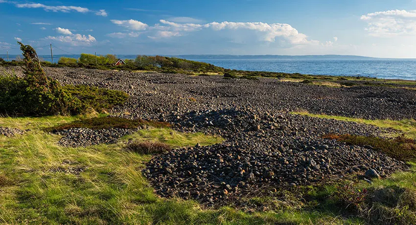
The Påarp Grave Field. Photo: Patrik Leonardsson
The Påarp Grave Field
Halland's largest grave field can be found in little Påarp, in southern Halmstad. The area comprises about 200 burial cairns and 50 cromlechs in various formations. Sänke Hög is the largest of the cairns. It is 30 metres in diameter and two metres high. The finds discovered here have been dated back to the early Iron Age. Don’t miss the 3.5 metre-high Slyngestenen erratic block, which is located just north of the grave field. According to legend, it was thrown there by a giant who wanted to silence the church bells in Trönninge, but missed.
The runestone and cultural heritage-focused walk in Kvibille
Kvibille has a rich history that has been beautifully showcased along a four kilometre-long culture walk. The walk is filled with stories from the Bronze Age all the way up until the 20th century. Finds have even indicated that the site has probably been inhabited since the Stone Age. Here you can see one of Halland's four runestones. It is walled into Kvibille Church and inscribed with the text Elfi and Thorgautr, they laid this stone over Thorlaker. May God help his soul. Take the opportunity to go on Kvibille's cultural walk and learn more about Halmstad's history.
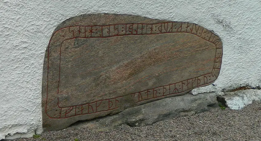
Runestone in Kvibille
The Vapnö Runestone
In the 19th century, the Vapnö Stone was discovered walled into the wall of an outhouse. It has since been located at Vapnö Castle. No one knows where it originally stood and it was long counted as a medieval work, but in recent years it has been reinterpreted as a Viking Age find dating from 900-1000 A.D. The decipherable parts of the inscription have been interpreted to read “to ... erected this stone in memory of... Christ help his soul”.
Vårhögen in Steninge
Directly adjacent to the parking lot of Steninge’s Enet Nature Reserve External link, opens in new window. you will find a path that takes you up to one of Halland's most impressive barrows. Vårhögen in Steninge is located at the top of the ridge and must have been a fantastic resting place, given its panoramic views of the Kattegat. During the Bronze Age, this type of cairn was common in coastal areas and indicated that the area was populated. On the way to the summit, almost hidden by juniper bushes, you can find a lonely gravestone that dates back to the Iron Age.
Vrenninge Grave Field
In eastern Oskarström you will find Vrenninge Grave Field, which was created during the Roman Iron Age. It was used for no more than 400 years, and is a showroom for all the grave types of that era, complete with cromlechs, stone circles, erected stones, an Iron Age dolmen and a trident. The size of the grave field indicates that it is a farm grave field, where a family and their relatives were laid to rest.
The Runestone in Getinge Church
On the porch of Getinge Church rests a runestone that was found walled into the oldest part of the church, and which was last erected around the year 1200. Its engravings are highly unusual, and include shapes resembling a wave, a bird, and a strange flower. The interpretation of the text reads: Rand had this stone erected ... Einar carved the runes. The researchers disagree about whether the stone was erected or used as a lid to a coffin.
More culture and history

More Halmstad
-
Inspiration and guides
Can I bring my dog to Halmstad? No problem!… -
Nature and the outdoor life
Ahh! The Halmstad air! Filled with the tangs… -
Beach and coast
Shimmering sea and colorful sunsets are only… -
Food and drink
Food and drink is not just food and drink.… -
Culture and history
In Halmstad we deliver both culture and history… -
Events
Theatre? Concerts? Art exhibitions? Sport?… -
Spa and wellness
Taking an invigorating dip in the sea, lacing… -
Shopping
Shopping is an experience in itself. Perhaps… -
The Swedish capital of golf
153 golf holes, eight unique resorts in a… -
Good to know
We have gathered together a few practical… -
Accommodation
Where would you like to stay? In a castle… -
Sports and activities
Do you like being active? Raising your pulse,…